37° Nordost – Urban development Gladbeck
Framework planning for Gladbeck’s neighborhoods along the B224
The expansion and covering of the main road in the middle of Gladbeck enables the development of new urban and open spaces on an area of 31 hectares.
The relocation of the B224 into a tunnel opens up great opportunities for the city of Gladbeck in terms of both content and space. The currently divisive effect of the B 224 will be eliminated; the districts and local recreation areas to the west and east of the formerly busy road will be cleverly interwoven through urban and open space planning developments. Where today noise, traffic and asphalt dominate and represent a barrier, a new spatial continuum with high open space quality and diverse uses is being created. Living space, jobs and educational opportunities are being created and existing districts are being further developed in a central location to the city center. The entrances to the city will be given a new face and a new part of Gladbeck will be created for living, working and leisure.
The city is using this transformation as an impetus to address overarching issues of climate adaptation, mobility transition, inner city development and social integration. In the field of tension between traffic calming, redensification and expansion of neighborhoods and open space networking, ’37° Nordost’ addresses central questions of current urban development, namely how can infrastructure and its transformation become the driving force behind sustainable urban development? How can mobility be rethought locally? How can the upgrading of urban districts and inner-city development succeed without promoting social segregation? How can green, networked spaces be optimally designed in the age of climate change so that they simultaneously offer meeting places for leisure and sport, increase biodiversity and enable active rainwater management?
For the city of Gladbeck, this project opens up the opportunity to take a new direction for future urban development. The importance of the project lies in its complexity, size and location. It is an infrastructure project and neighborhood development at the same time and requires the consideration of societal and social aspects as well as finding solutions for the sustainable design of urban and open spaces.


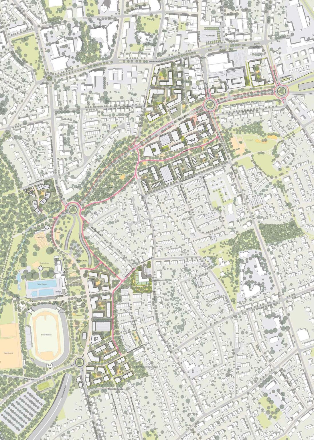
The urban development affects a central area of the city of over 1.5 km in length near the city center, which is currently still dissected by the main road. By covering the B224, a contiguous area will be created here, on which new urban quarters, educational locations, sports and leisure areas as well as green recreational spaces will be realized. New commercial space, around 1,100 residential units, three daycare centers and additional neighborhood uses will be created in three districts.
The new, central city street, which runs above the future highway, is part of the public space. It serves as a local access route in a north-south direction, but does not accommodate through traffic and is no longer free of extensions, but instead links the adjacent neighborhoods and connects them through simple crossings and a variety of green spaces. All road users are treated equally. The new city street does not emphasize linearity, but rather the respective spatial situations in the context of the surroundings and the urban development goals. In this way, it is implemented in parts as a shared space and thus becomes a model space for a new, equal mobility. Starting from it, a close-knit network of footpaths and cycle paths will be created, linking the central locations in Gladbeck and the three new urban districts and creating a high degree of permeability in the urban space. New open spaces along the city street complement and densify the existing open space system and offer a high quality of living. Climatically effective open space corridors are being created that include urban meeting places, parks and landscaped retreats.
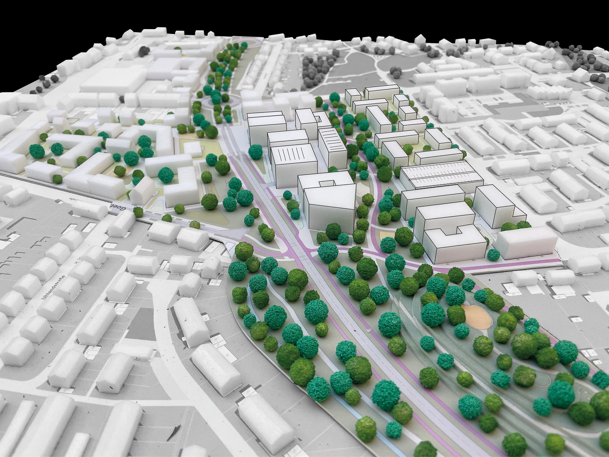
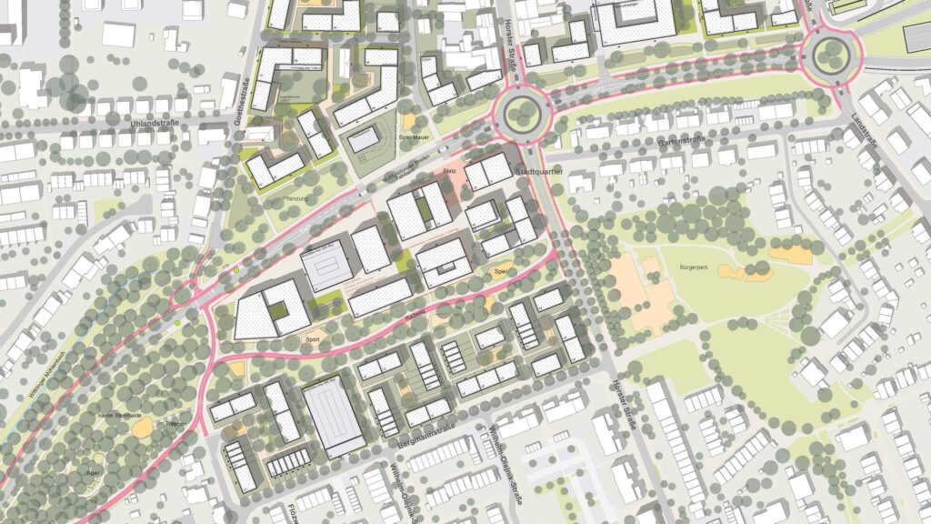
In terms of urban space and function, the three new districts are linked to the existing settlement structures and also form a central campus that brings together various educational facilities. In conjunction with existing schools, the campus creates a spatially coherent loop that strengthens the educational offer in Gladbeck and increases its visibility. The individual sub-areas have distinct qualities to offer a colorful and socially balanced range of living space, from urban and dense in inner city locations to quiet residential areas, whilst always maintaining an appropriate density. Social and educational facilities such as schools and kindergartens will be connected to the existing buildings and newly accommodated in the Loop.
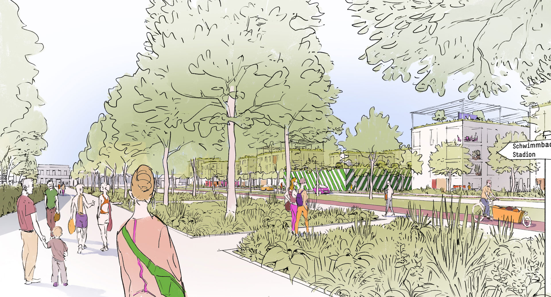
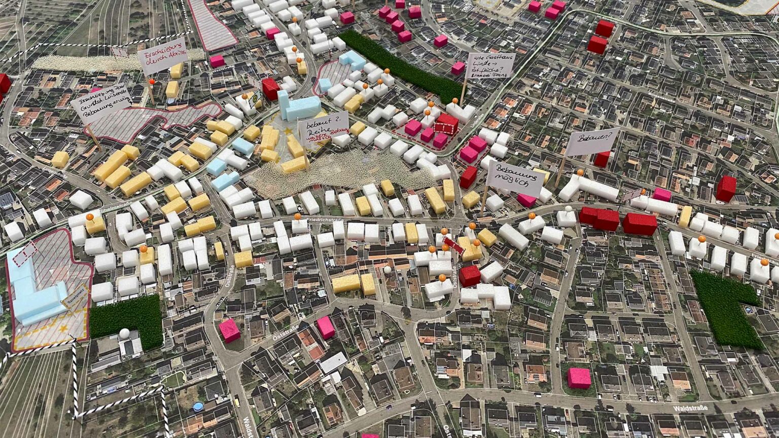
’37° Nordost’ uses the transformation of infrastructure to create new places worth living in. Breaks in the urban fabric are transformed into connecting spaces with added social, ecological and economic value. Enhancements, improved accessibility and connectivity of the former traffic area, including adjacent areas, acts as a kind of particle accelerator for existing urban development and open space systems. A double ring closure makes it possible to link the inner-city open spaces, schools and public facilities in the north with the large local recreation areas in the west and southeast. The project was accompanied by a close exchange with the public and local residents. Their concerns and needs became part of the process, as did the necessary guidelines at federal and state level, which are crucial for the infrastructure. The urban development master plan and the process is therefore also an important instrument for communication and agreement on common objectives.
Client
City of Gladbeck
Size
31 ha
Planning and implementation
2023-today
Service
Urban design competition, 3rd place, urban master plan, design manual
Cooperation
Planning group, Essen
Link
37° northeast
Photo credit: ASTOC