Spatial strategy for the Rhineland mining area 2038+
Spatial model for structural change in the Rhine lignite mining area
How can Europe's largest landscaping site master the challenge of structural change?
Lignite mining has shaped the Rhine mining area since the 1950s. The phase-out of lignite will significantly change this region, and not just through the economic reprofiling of the mining area. The direction of travel already seems to be set: The Rhine mining district wants to become the first climate-neutral model region in Europe. The key questions are, how can the region become climate-neutral and how can it become efficient?
The early phase-out of lignite-fired power generation in 2030 has been decided. This means that the Rhine mining district is already undergoing a transformation process that will completely alter the landscape and the economy in the long term. The region is faced with the task of shaping economic change, re-branding itself as a location and tackling strategic challenges at all levels of planning simultaneously regenerating the landscape, habitat networking of flora and fauna, establishing new and sustainable forms of agriculture, generating renewable energies, securing existing jobs and creating new ones, implementing new forms of settlement and the mobility transition in rural areas. In order to manage the transformation, three interdisciplinary teams have developed ideas for a ‘Spatial Strategy 2038+’ in a cooperative process.


Primarily, the 65 cities and municipalities of the Rhineland mining district are shaping the transformation. This results in very different perspectives and requirements. A central question for the success of the transformation and the implementation of common goals is, how can each municipality be offered its own development perspective within the transformation process that also contributes to the goals of the spatial strategy for the district?
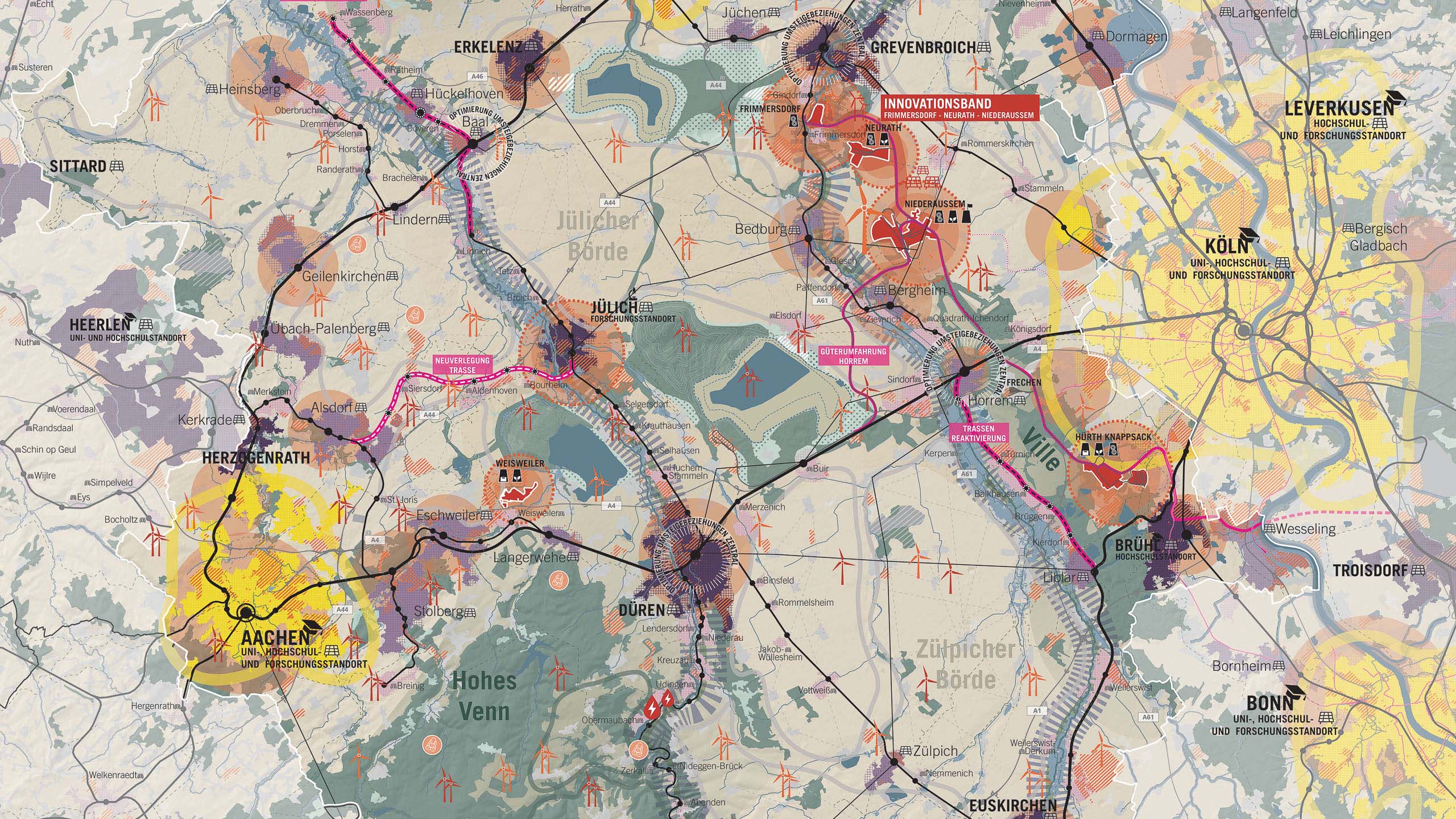
Two aspects form the foundation for long-term settlement development in the district. An efficient public transport network as a structuring element of settlement development and a typification of existing settlements to guide polycentric settlement development. Together with the preservation and use of the district’s natural resources in order to preserve the basis of life for future generations and to enable diverse and robust production landscapes, they form the four strategies of the spatial image.
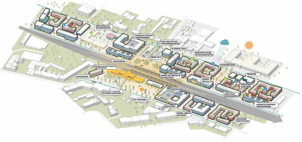
The structural change in the Rhine mining area is being felt most strongly in production. With the loss of coal-fired power, the region must rethink the location of jobs and the use of land potential. The central locations in the cities and larger municipalities in particular offer the opportunity to locate new and high value-added jobs in the direct vicinity of university locations and research centers, so-called mobility districts. These are located around public transport stops and are suitable locations for companies with a high job density and special requirements for an urban environment.
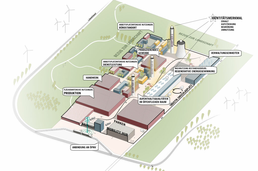
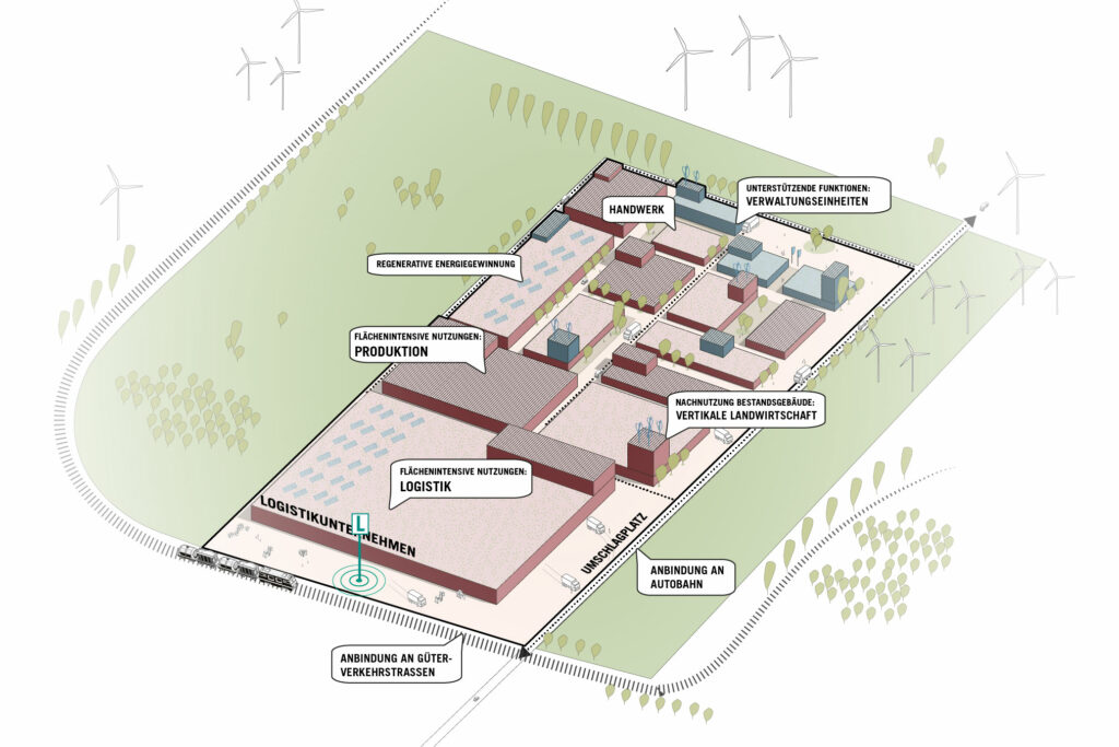
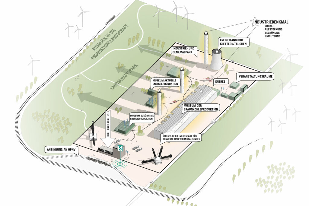
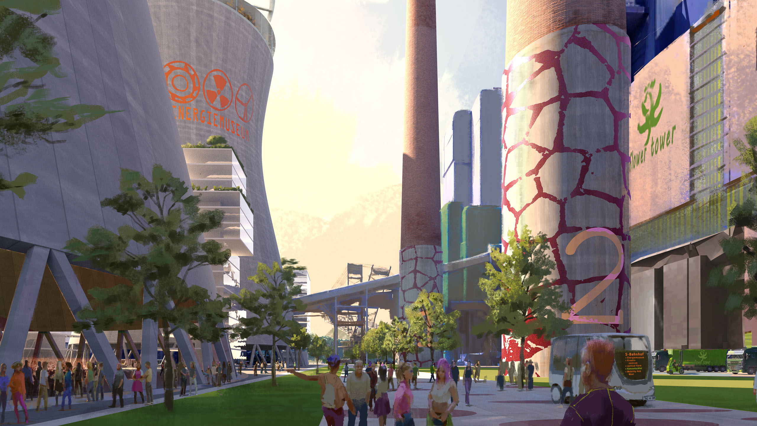
As sealed and designated areas of almost 600 ha, the current power plant sites are of central importance for structural change. The power plant sites are to be developed as inter-municipal commercial and industrial areas, enabling the surrounding municipalities to reuse the recultivation areas free of financial pressure, also in terms of landscape, and to jointly use the well-developed areas as locations for future technologies that position the district as a location in Europe and worldwide.
The 2050+ structure plan shows what the Rhine mining district could look like in 2050. It formalises the spatial approach and combines the individual strategies. It shows where each spatial function has priority or where several tasks or potentials overlap. The sectoral strategies have not been broken down into individual topics, but rather grouped into four spatial systems.
In order to shape structural change, a change in thinking is needed in some areas. A change of perspective is a prerequisite for recognizing new possibilites for action. The Rhine mining district should not see sustainability as a purely ecological measure and requirement. Only sustainability can create a high-performance region. This requires a network of stakeholders who are willing to move forward together.
Client
RWTH Aachen, Chair of Urban Planning and Design
Size
4,800 km²
Planning
2021-2022
Service
Spatial strategy with mission statement as part of a cooperative, public workshop process, participation in the synthesis phase
Collaboration
urbanista.ch, Zurich (CH), LOLA landscape architects, Rotterdam (NL), mrs Verkehrsplanung, Zurich, (CH), Futur A Zukunftsforschung
Photo credit: ASTOC